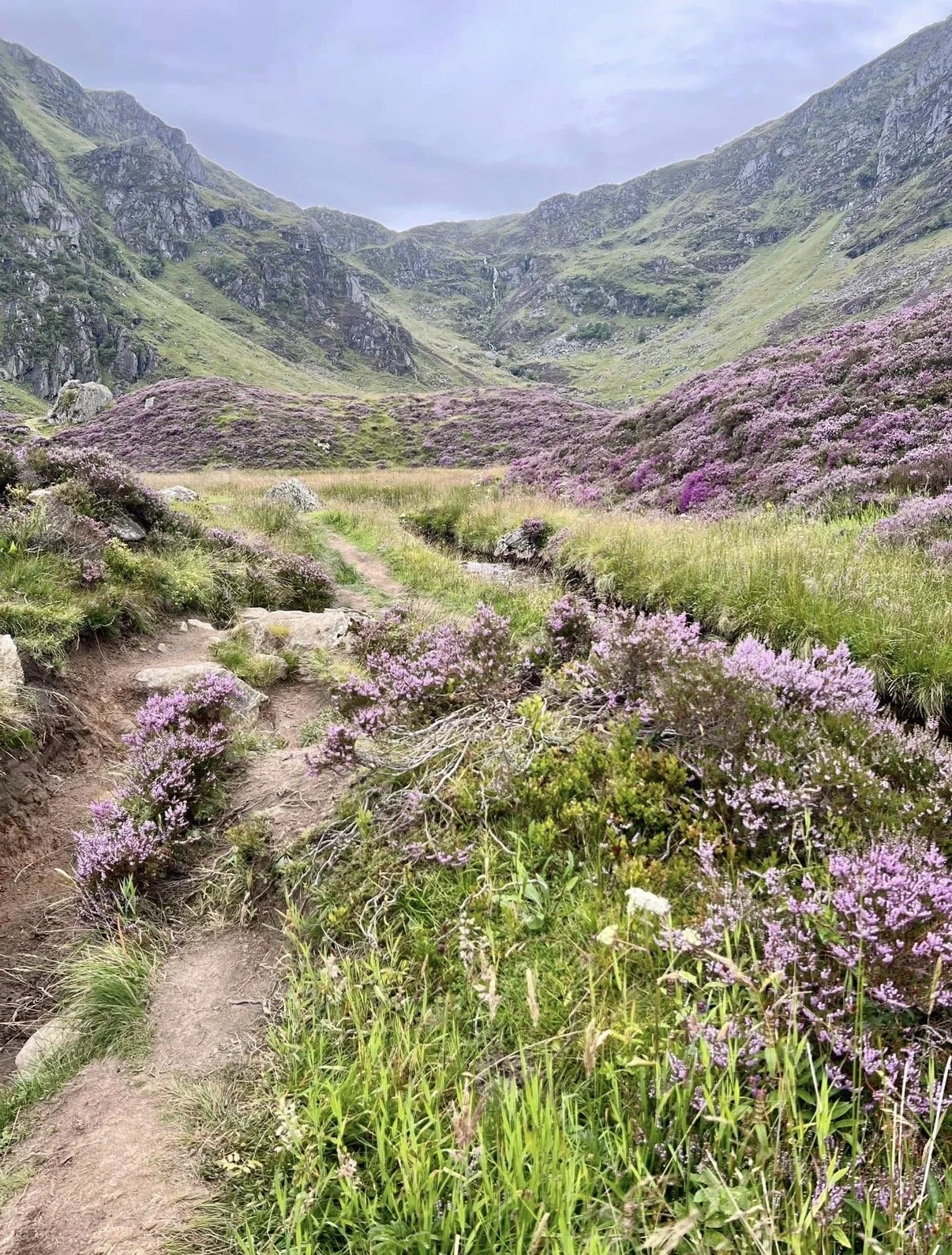
INTERMEDIATE PENTLAND RIDGE WALK/HILL SKILLS
OVERVIEW
Difficulty: Moderate
Distance: 12.25 km/7.5 miles
Duration: 6-7 hours
ROUTE
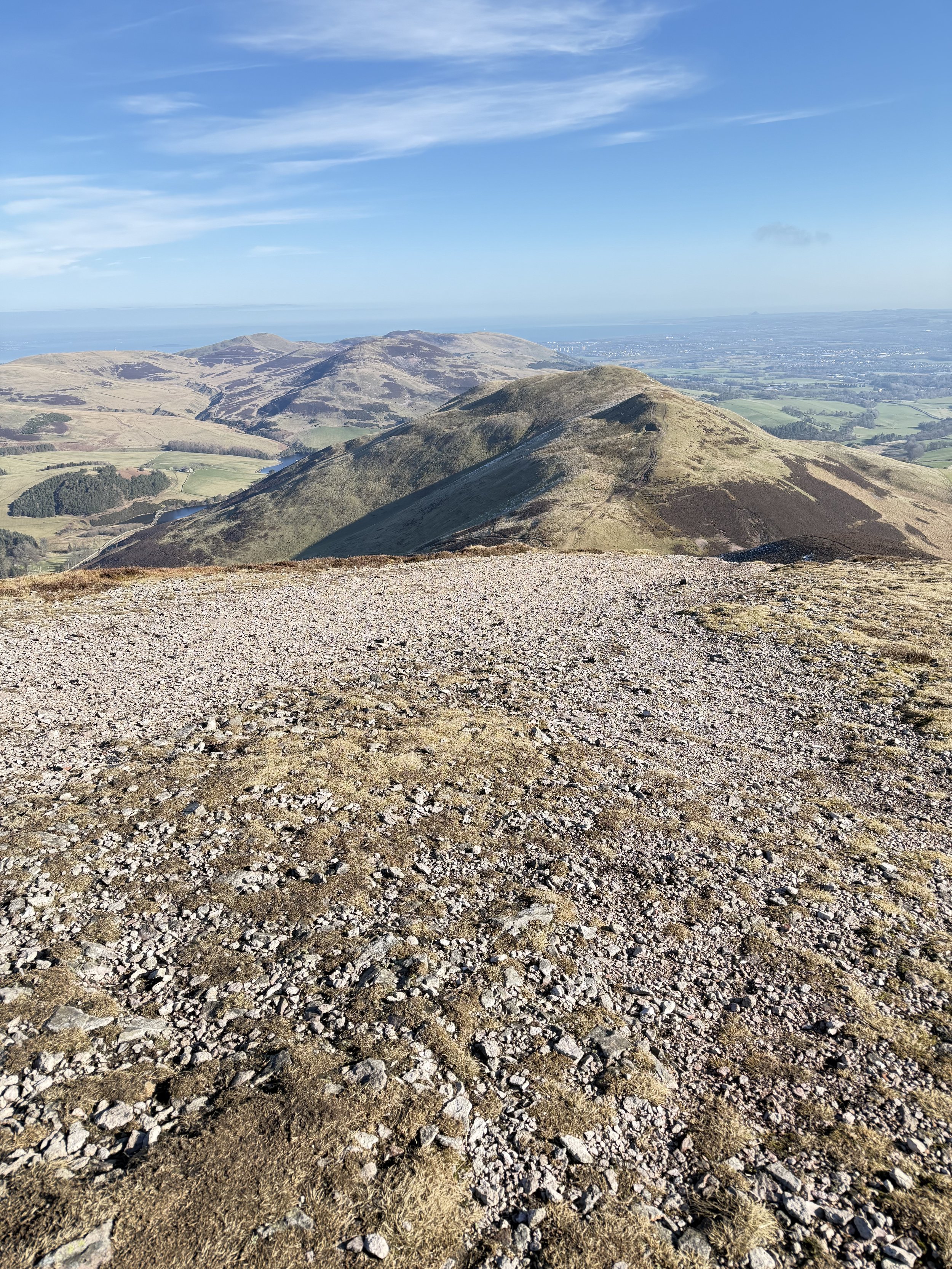
The route starts at Flotterstone car park (charge) and heads up and over Turnhouse Hill. This is a steep start but a very good warm up! It is a short drop from Turnhouse before heading up to the rocky cairn on the summit of Carnethy Hill. This is followed by a longer drop downhill before heading up to the flat top of Scald Law which is the highest top of the Pentland HIll range. At various points during the walk, we will stop, have some snacks and drinks, discuss and practice some skills that are necessary to safely travel through the mountains. Serious skills but training should always be fun and that will be one of the aims rain, hail or shine!
HILL SKILLS
Learn the basic skills to enable you operate safely in the mountain environment
Intro to Map & Compass
Planning
Weather Forecasts
How to pack your rucksack and what to take
Moving on steep ground
Emergency Procedures
Start Time: 0730
Meeting Point: Flotterstone Car Park, Pentland Hills Regional Park, EH25 0PP
TERRAIN AND DIFFICULTY
This walk involves grassy and rocky paths with steep gradients. Walkers should have a good level of fitness and be prepared for variable weather conditions
FITNESS LEVEL
You should be comfortable walking for at least 10km with a rucksack as a minimum but rest assured that the pace will be gentle with stops along the way. Some experience of walking uphill will be required
KIT LIST
The following items are essential for a day in the hills
Full set of waterproofs
Pair of sturdy walking boots
Base, mid and outer layer
Hat, gloves, snood or scarf
Food, snacks and water to keep you going throughout the day
Headtorch
A rucksack to carry everything. 30-35 Litres is ideal
Ben Macdui
OVERVIEW
Difficulty: Moderate
Distance: 8km/12 miles
Duration: 7-8 hours
ROUTE
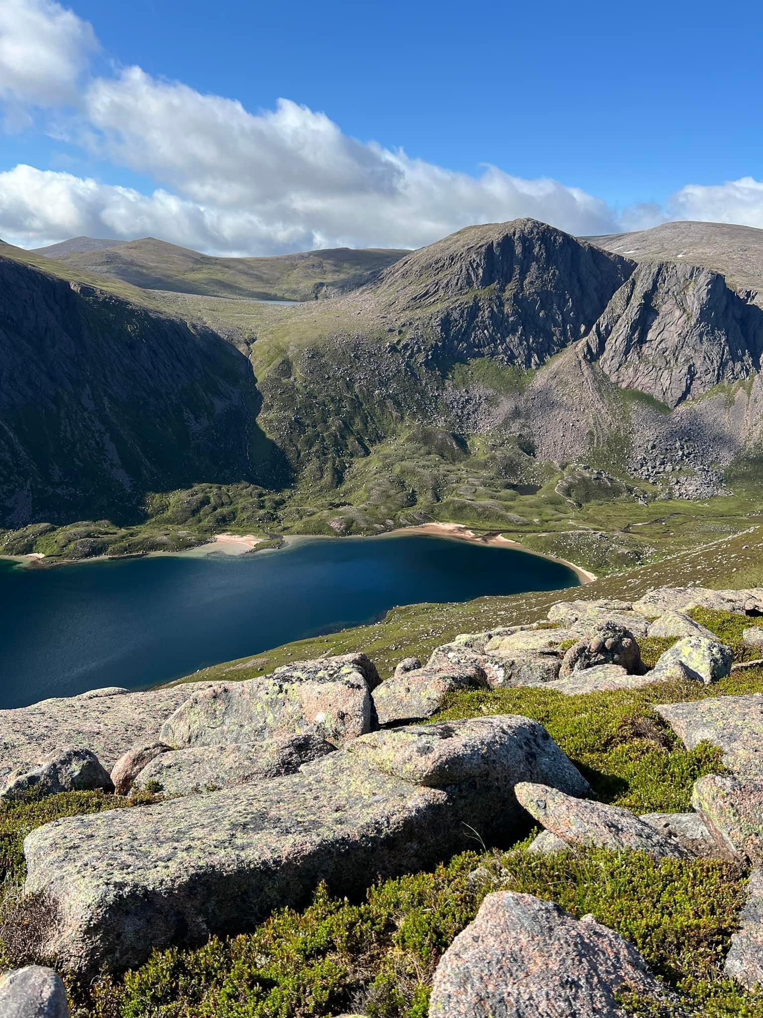
The route begins at the Cairngorm Ski Centre and heads across the moor under the beautiful Northern Corries and eventually onto the ridge of Miadan Creag an Leth-choin. The path then gently rises under the shadow of the munro Cairn Lochan and meets with another path on the lower slopes of Ben Macdui. There is a small boulder field to cross before heading up past multiple cairns to the summit. On a clear day there are striking views across the chasm of the Lairig Ghru to the high munros on the other side. Braeriach (3rd highest munro) is particularly striking! Return by the same route.
Start Time: 0700
Meeting Point: Cairngorm Ski Centre, Aviemore PH22 1RB
TERRAIN AND DIFFICULTY
This walk involves challenging terrain, with rocky paths and steep gradients. Walkers should have a good level of fitness and be prepared for variable weather conditions
FITNESS LEVEL
You should be comfortable walking for at least 15 km with a rucksack as a minimum but rest assured that the pace will be gentle with stops along the way.
KIT LIST
The following items are essential for a day in the hills
Full set of waterproofs
Pair of sturdy walking boots
Base, mid and outer layer
Hat, gloves, snood or scarf
Food, snacks and water to keep you going throughout the day
Headtorch
A rucksack to carry everything. 30-35 Litres is ideal
BEN VORLICH (Lochearnhead)

OVERVIEW
Difficulty: Moderate
Distance: 10km/6 miles
Duration 6-7 Hours
ROUTE
The route begins on a track before head out over open heather slopes. As the path nears the summit, it becomes increasingly eroded and steep especially towards the summit but there is an alternative nearby path to take if required. It is a fine viewpoint for a vast tract of Scotland. Return is by the same route.
Start Time: 0700
Meeting Point: Ardvorlich near Lochearnhead, FK19 8QE
TERRAIN AND DIFFICULTY
This walk involves a well made, gently rising path culminating in rocky paths and steep gradients near the summit, Walkers should have a good level of fitness and be prepared for variable weather conditions
FITNESS LEVEL
You should be comfortable walking for at least 10km with a rucksack as a minimum but rest assured that the pace with be gentle with stops along the way.
KIT LIST
The following items are essential for a day in the hills
Full set of waterproofs
Pair of sturdy walking boots
Base, mid and outer layer
Hat, gloves, snood or scarf
Food, snacks and water to keep you going throughout the day
Headtorch
A rucksack to carry everything. 30-35 Litres is ideal
BUACHAILLE ETIVE BEAG
(STOB DUBH & STOB COIRE RAINEACH)

OVERVIEW
Difficulty: Moderate
Distance: 8km/5 miles
Duration: 6-7 hours
ROUTE
A well constructed path leads up towards Mam Buidhe, the bealach (saddle) between the two munros. The first objective is Stob Dubh. The path narrows near the top where we will (weather permitting) have sensational views towards Glencoe and Loch Etive. The second munro is reached by retracing our steps to the bealach and heading up a steep rocky path for a short distance to the summit. From here there are extensive views down and across Glencoe. Return by the same route.
Start Time: 0700
Meeting Point: Glencoe car park opposite ‘Beehive Cairn” off the A82
TERRAIN AND DIFFICULTY
This walk involves well constructed paths which become rocky with steep gradients. Walkers should have a good level of fitness and be prepared for variable weather conditions
FITNESS LEVEL
You should be comfortable walking for at least 10km with a rucksack as a minimum but rest assured that the pace will be gentle with stops along along the way.
KIT LIST
The following items are essential for a day in the hills
Full set of waterproofs
Pair of sturdy walking boots
Base, mid and outer layer
Hat, gloves, snood or scarf
Food, snacks and water to keep you going throughout the day
Headtorch
A rucksack to carry everything. 30-35 Litres is ideal
THE MERRICK

OVERVIEW
Difficulty: Moderate
Distance: 13km/8 miles
Duration: 6-7 hours
ROUTE
Discover the hidden, rugged, beauty of Dumfries & Galloway on a memorable walk to the summit of ‘The Merrick’ which is both the highest mountain in southern Scotland and a also a Corbett. The route begins at the car park near Bruce’s Stone and makes its way diagonally uphill before meandering through a couple of forestry plantations. Leaving the trees behind, it emerges onto the open hillside and expansive views of the surrounding area begin to open up. We reach the top of Benyellary first before making our way along the narrow ridge to the summit of the Merrick. Weather permitting we’ll take the time to take in the panaorama before us. Return is by the same route. This walk is perfect for those seeking a rewarding challenge in and around one of Scotland’s lesser known but stunning areas.
Start time: 0800
Meeting Point: Car park adjacent to Bruce’s Stone, Glentrool, Newton Stewart, DG8 6SU
TERRAIN AND DIFFICULTY
This walk involves challenging terrain, with rocky paths and steep gradients. Walkers should have a good level of fitness and be prepared for variable weather conditions
FITNESS LEVEL
You should be comfortable walking for at least 10km with a rucksack as a minimum but rest assured that the pace will be gentle with stops along the way
KIT LIST
The following items are essential for a day in the hills
Full set of waterproofs
Pair of sturdy walking boots
Base, mid and outer layer
Hat, gloves, snood or scarf
Food, snacks and water to keep you going throughout the day
Headtorch
A rucksack to carry everything. 30-35 Litres is ideal
Beinn Ghlas & Ben Lawers
OVERVIEW
Difficulty: Moderate
Distance: 11 km/6.75 miles
Duration: 6-7 hours
ROUTE
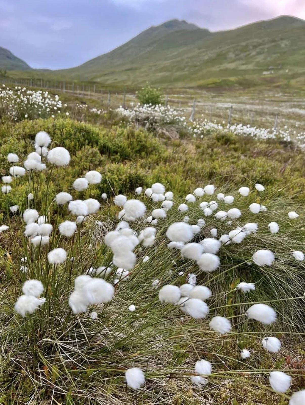
The route begins on an excellent path weaving round some exceptional flora, including some rare arctic-alpine plant species which are dispersed throughout the walk. The path gradually steepens until we meet the first summit which affords some exceptional views of Loch Tay. We drop off the summit of Beinn Ghlas and walk along the broad summit before climbing more steeply on a narrowing, stony path to the summit of Ben Lawers, the 10th highest Munro in Scotland
Start time: 0700
Meeting Point: Car park, National Trust for Scotland, FK21 8TY, £4 for non NTS members
TERRAIN AND DIFFICULTY
This walk involves challenging terrain once nearing the summit with rocky paths and steep gradients. Walkers should have a good level of fitness and be prepared for variable weather conditions
FITNESS LEVEL
You should be comfortable walking for at least 10km with a rucksack as a minimum but rest assured that the pace will be gentle with stops along the way
KIT LIST
The following items are essential for a day in the hills
Full set of waterproofs
Pair of sturdy walking boots
Base, mid and outer layer
Hat, gloves, snood or scarf
Food, snacks and water to keep you going throughout the day
Headtorch
A rucksack to carry everything. 30-35 Litres is ideal
Ben Vorlich (Loch Lomond)
OVERVIEW
Difficulty: Strenuous
Distance: 13.5 km/8.5 miles
Duration: 6 - 7 hours
ROUTE
The route starts off on a rising track before turning off onto the hill path signalled by a cairn. For the first 300 metres the going is steep and relentless but this means that height is gained quickly! The angle eases after this as progress is made through rocky terrain to access the summit ridge. The views from the top are excellent with Ben Lui and Ben Lomond prominent.
Start Time: 0700
Meeting Point: Inveruglas Visitor Centre (Pay & Display car park) G83 7DP
TERRAIN & DIFFICULTY
This route involves a steep ascent which progresses through rocky terrain. Walkers should have a good level of fitness and be prepared for variable weather conditions.
FITNESS LEVEL
You should be comfortable walking for at least 10 km with a rucksack as a minimum but rest assured that the pace will be gentle with stops along the way.
KIT LIST
The following items are essential for a day in the hills
Full set of waterproofs
Pair of sturdy walking boots
Base, mid and outer layer
Hat, gloves, snood or scarf
Food, snacks and water to keep you going throughout the day
Headtorch
A rucksack to carry everything. 30-35 Litres is ideal
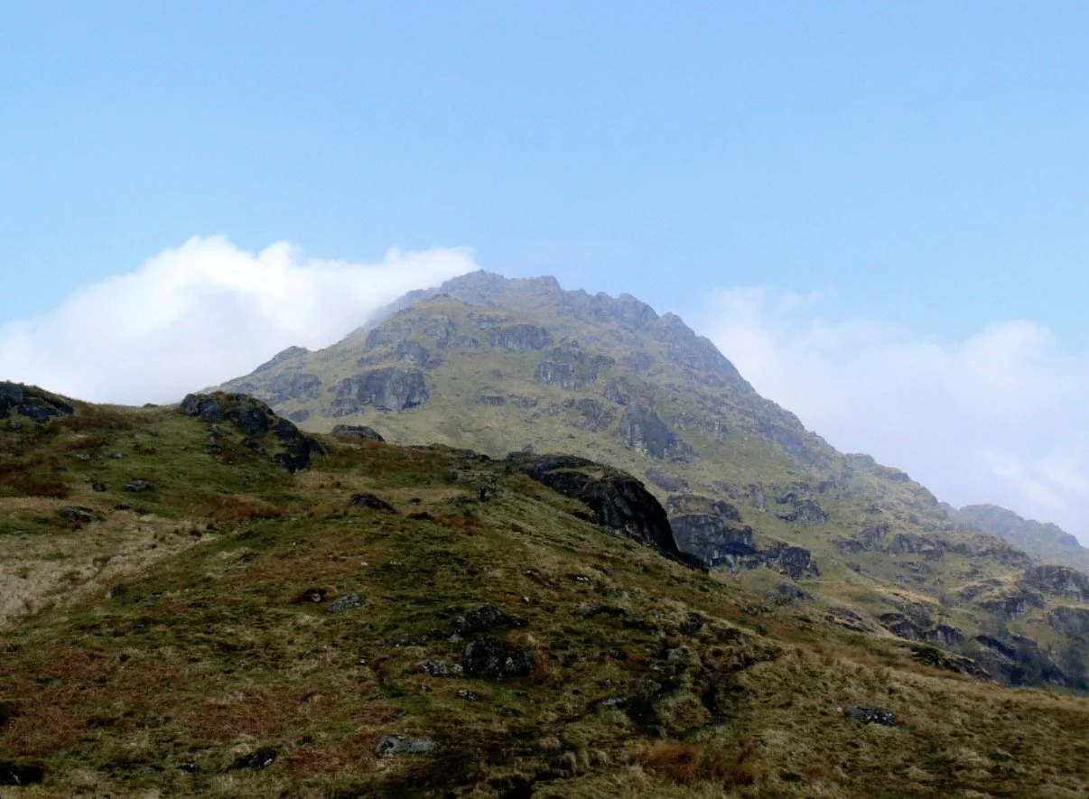
Ben Vane
OVERVIEW
Difficulty: Strenuous
Distance: 11 km/6.75 miles
Duration: 5.5 - 7 hours
ROUTE
The route starts off on a surfaced road, then follows tracks and paths until a stone stepped path is reached at 450 metres. A boggy area is then crossed before regaining the path which then accesses the SE ridge of Ben Vane. The going is steep and rocky with a fair amount of zig-zagging required to help ease the gradient. There are rocky sections affording mild scrambling, but these can be avoided on either side. Once the summit is accessed, the views extend from the Isle of Arran to Ben Nevis
Start Time: 0700
Meeting Point: Inveruglas Visitor Centre (Pay & Display car park) G83 7DP
TERRAIN & DIFFICULTY
This route involves a steep ascent which progresses through rocky terrain. Walkers should have a good level of fitness and be prepared for variable weather conditions.
FITNESS LEVEL
You should be comfortable walking for at least 10 km with a rucksack as a minimum but rest assured that the pace will be gentle with stops along the way
KIT LIST
The following items are essential for a day in the hills
Full set of waterproofs
Pair of sturdy walking boots
Base, mid and outer layer
Hat, gloves, snood or scarf
Food, snacks and water to keep you going throughout the day
Headtorch
A rucksack to carry everything. 30-35 Litres is ideal
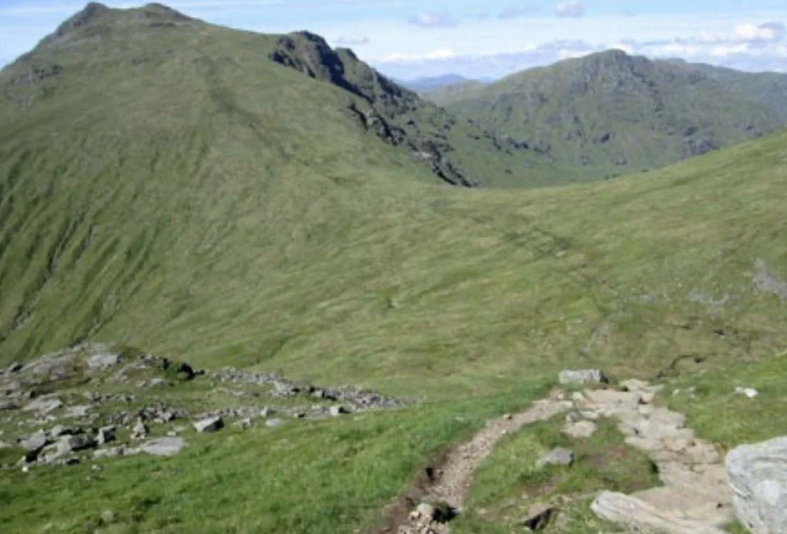
Beinn Narnain & Beinn Ime
OVERVIEW
Difficulty: Strenuous
Distance: 13.5 km/8.5 miles
Duration: 7-8 hours
ROUTE
The route climbs directly through trees, crosses a forest track and then follows the line of old concrete bases which were used in the construction of a hydro-scheme. This path can be steep and eroded in places. once emerging from the trees, a path traverses the hill-side before reaching Beinn Narnain’s south-east ridge. A flat area is then crossed before reaching a rocky ridge which leads to Cruach nam Miseag at 813 m. After this point the ridge steepens and becomes rockier but the path weaves between the rocks to reach the rock prow guarding the summit. We will pass to the right of the main buttress to ascend the rock-filled gully. Mild scrambling at this section before the final path to the summit of Beinn Narnain on easier ground. Weather permitting there will be a great view down Loch Long to the Firth of Clyde. After a break at the summit, we will head down to the Bealach a ‘ Mhaim on a well made path. From here we will ascend 400m to reach the summit of Beinn Ime via a well made path on its broad and grassy slopes. Beinn Ime is the highest at 1011m, of the so called Arrochar Alps which encompass these two plus the Cobbler (Corbett) Ben Vane, Ben Vorlich and The Brack (Corbett)
Start Time: 0700
Meeting Point: Car Park at Succoth (charge) G83 7AP
TERRAIN & DIFFICULTY
This route involves a steep ascent which progresses through rocky terrain terminating with a section of mild scrambling. Walkers should have a good level of fitness and be prepared for variable weather conditions.
FITNESS LEVEL
You should be comfortable walking for at least 10 km with a rucksack as a minimum but rest assured that the pace will be gentle with stops along the way
KIT LIST
The following items are essential for a day in the hills
Full set of waterproofs
Pair of sturdy walking boots
Base, mid and outer layer
Hat, gloves, snood or scarf
Food, snacks and water to keep you going throughout the day
Headtorch
A rucksack to carry everything. 30-35 Litres is ideal
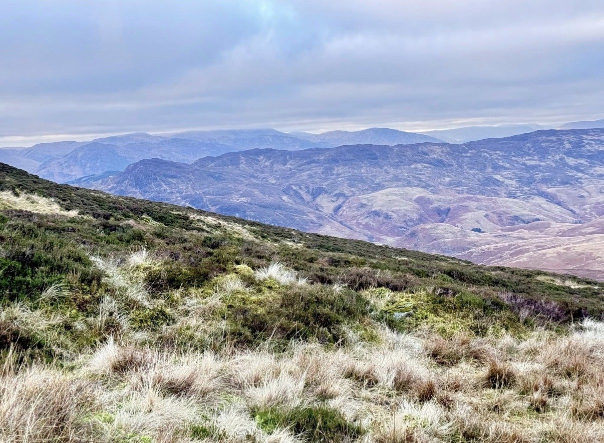
BEN CHONZIE
OVERVIEW
DIFFICULTY Moderate
Distance: 12.5 km/7.75 miles
Duration: 5-6 hours
ROUTE
The route is straight forward and for the first few km follows a track up to about 720m before we turn off to strike up the heather moorland to the summit following a line of old fenceposts as we near the summit plateau
Start Time: 0700
Meeting Point: Start of Coishavachan track Grid Reference NN743272
TERRAIN & DIFFICULTY
This route is straightforward and ideal for beginners. Walkers should have a good level of fitness and be prepared for variable weather conditions.
FITNESS LEVEL
You should be comfortable walking for at least 10 km with a rucksack as a minimum but rest assured that the pace will be gentle with stops along the way
KIT LIST
The following items are essential for a day in the hills
Full set of waterproofs
Pair of sturdy walking boots
Base, mid and outer layer
Hat, gloves, snood or scarf
Food, snacks and water to keep you going throughout the day
Headtorch
A rucksack to carry everything. 30-35 Litres is ideal
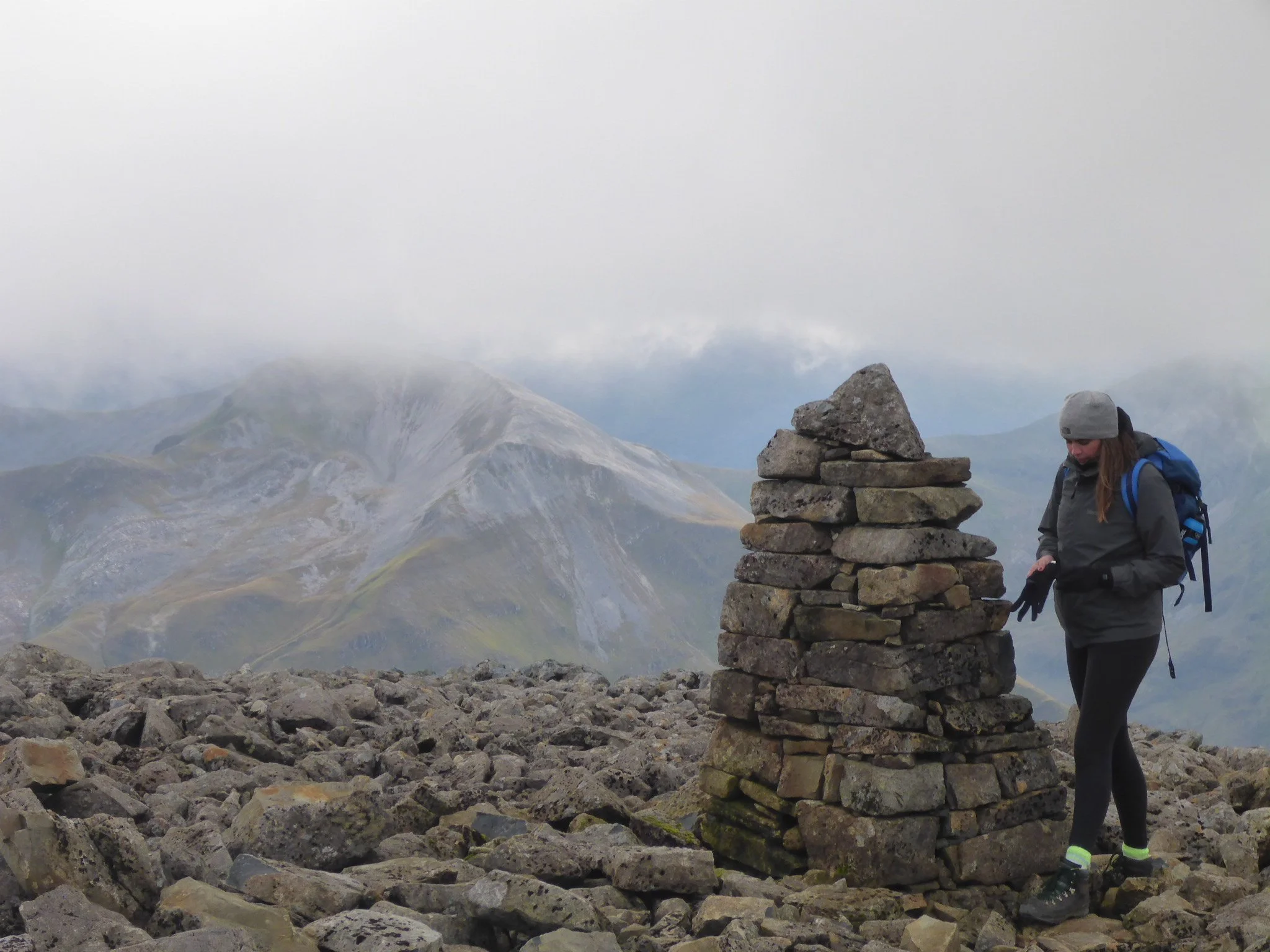
BEN NEVIS
OVERVIEW
DIFFICULTY Moderate/Strenuous
Distance: 17km/10.5 miles
Duration: 8-10 HOURS
ROUTE
Ben Nevis needs no introduction as the highest mountain in the UK. The route is straightforward but strenuous due to the distance and height gained. The path is steep throughout apart from a levelling off at the half way lochan which is an ideal spot for a break. The path thereafter is very rough and stony. Views are pretty special but The Ben has a habit of being cloud capped! Best to grab these views while we can which is usually en route rather than at the summit.
Start Time: 0700
Meeting Point: Glen Nevis Visitor Centre Car Park (charge), Glen Nevis, PH33 6ST
TERRAIN & DIFFICULTY
This route is on a well maintained path. Steep and rocky most of the way. Difficulty is related to the distance and height gained. Waterproofs and layers essential due to temperature differential between the start point and the summit
FITNESS LEVEL
You should be comfortable walking for at least 15 km with a rucksack as a minimum but rest assured that the pace will be gentle with stops along the way
KIT LIST
The following items are essential for a day in the hills
Full set of waterproofs
Pair of sturdy walking boots
Base, mid, outer layer and spare layer
Hat, gloves, snood or scarf
Food, snacks and water to keep you going throughout the day
Headtorch
A rucksack to carry everything. 30-35 Litres is ideal
MAYAR & DRIESH
OVERVIEW
DIFFICULTY Moderate
Distance: 14.4 km/9 miles
Duration: 7-8 HOURS
ROUTE
The route begins on a track in Glen Doll, near before joining a well maintained path through the dramatic Corrie Fee. Corrie. Fee is a National Nature Reserve home to several rare alpine and arctic plants as well as golden eagles and peregrine falcons. The path, after passing a waterfall, leads onto the extensive plateau. After attaining the summits of both Mayar and Driesh, return is by the Kilbo path making this a fantastic but straightforward circular route.
Start Time: 0700
Meeting Point: Glen Doll Car Park (charge), near Kirriemuir, DD8 4RD
TERRAIN & DIFFICULTY
This route is on a track before reaching a well maintained path through Corrie Fee. The path on the plateau is indistinct but follows old fence posts most of the way. The return path is rough and stony.
FITNESS LEVEL
You should be comfortable walking for at least 15 km with a rucksack as a minimum but rest assured that the pace will be gentle with stops along the way
KIT LIST
The following items are essential for a day in the hills
Full set of waterproofs
Pair of sturdy walking boots
Base, mid, outer layer and spare layer
Hat, gloves, snood or scarf
Food, snacks and water to keep you going throughout the day
Headtorch
A rucksack to carry everything. 30-35 Litres is ideal